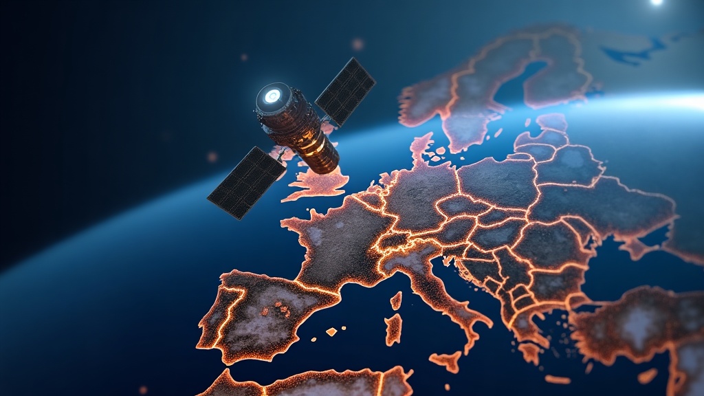
GPS Disruption Over Europe: The Satellite Mystery Explained
Quick Summary
A powerful satellite has been jamming GPS signals across Europe. Here's what researchers found, how GPS actually works, and why this matters for everyone.
In This Article
A Signal From Nowhere — and Everywhere at Once
In late 2024, GPS researcher Professor Todd Humphreys at the University of Texas at Austin received an anonymous tip: look at two specific timestamps buried inside years of publicly available GPS monitoring data. The expectation was low. The data had been sitting online since 2021, and if anything dramatic were hiding in it, surely someone would have noticed.

They hadn't. What Humphreys and his student Zach Clements found was startling: at two precise moments, receivers scattered across an entire continent all reported the same thing simultaneously — a sudden, sharp drop in signal-to-noise ratio. Not a gradual fade. Not a slow build. A drop of roughly a factor of ten, lasting just three to five seconds. And when they went looking for more, they found 75 days of identical events stretching back to 2019.
This wasn't a glitch. Something was disrupting GPS signals across Europe — deliberately or otherwise — and nobody in the public research community had noticed for years.
How GPS Actually Works (And Why It's Surprisingly Fragile)
To understand what was being disrupted, it helps to understand what GPS is actually doing. Your phone isn't passively detecting your location — it's solving a physics problem in real time.
Each GPS satellite broadcasts two pieces of information: its position in space and the exact time the signal was sent. Your phone records when that signal arrives, calculates the difference, multiplies by the speed of light, and gets a distance. One satellite places you somewhere on a sphere. Two satellites narrow it to a circle. Three narrow it to two points. One of those is in space, so the other must be you.
Except it's not quite that clean. Your phone doesn't have an atomic clock. GPS satellites do — ones that drift by roughly three seconds every million years. Your phone's clock can drift by that much in a couple of days. A timing error of just 100 nanoseconds throws your position off by 30 metres. So instead of solving for three unknowns (x, y, z), you're solving for four — including your clock error (b). That requires a fourth satellite to make the system solvable.
But the corrections don't stop there. In the fraction of a second a signal travels from orbit to your pocket, Earth has rotated slightly. Ignore that, and you're off by around 20 metres. The ionosphere adds 5 to 15 metres of error. The lower atmosphere adds another metre or two. Special and general relativity, if left uncorrected, would cause position to drift by about 11 kilometres per day. Modern receivers handle all of this — but every correction depends on being able to hear the satellites clearly in the first place.
Here's the fragility: a GPS satellite transmits with about 50 watts of power from 20,000 kilometres away. By the time that signal reaches your phone, it carries roughly 10⁻¹⁶ watts — a tenth of a quadrillionth of a watt. It doesn't take much to overwhelm it.
The Strange Geometry of a Continental-Scale Disruption
When Humphreys and Clements mapped the affected stations, the disruption stretched from Svalbard in the Arctic to Spain in the south, from eastern Poland to Canada in the west. That is not a local jamming problem. A tower-mounted jammer, even on the tallest structure in Kaliningrad — a heavily militarised Russian exclave on the Baltic Sea that had already attracted attention as a source of regional electronic warfare — could at best affect aviation up to roughly the distance of Denmark.
The geometry ruled out any ground-based source entirely. Earth's curvature blocks radio signals over continental distances. To affect all those stations simultaneously, the source had to be above the horizon for every one of them at the same time. Working through the most conservative assumptions, the researchers calculated the source had to be at least 1,200 kilometres above the Earth's surface. That's higher than the International Space Station.
Could it be the sun? Solar radio bursts do interfere with GPS, and a major solar storm in November 2025 disrupted positioning globally for several hours. But solar interference tends to build over tens to hundreds of seconds, spans a wide range of frequencies, and affects the entire sunlit face of the planet. What Humphreys and Clements were seeing was a three-to-five second burst, confined to a five-megahertz window centred precisely at 1,577.5 MHz — the exact frequency band used by GPS — and geographically concentrated over Europe. The sun was ruled out.
The only remaining explanation: a satellite was doing this.
Accidental Failure or Deliberate Jamming?
The obvious next question is intent. Satellites malfunction. Amplifiers overheat. Hardware misbehaves. Could this be a satellite glitch that happened to fall in a sensitive frequency band?
The data pushed back hard against that theory. Random hardware failures don't follow a schedule. These interference events clustered on Tuesdays, Wednesdays and Thursdays, during European business hours. As Humphreys put it: no amplifier fails specifically on Wednesday afternoons in Europe. Human involvement seemed almost certain — though that still left open whether it was intentional targeting or some kind of inadvertent operational process.
Jamming — broadcasting a stronger signal on the same frequency to drown out satellite signals — is illegal in most countries. The frequency bands used by GNSS systems (roughly 1.1 to 1.6 GHz) are tightly protected internationally. This range is a deliberate engineering choice: low enough to travel well through the atmosphere without requiring enormous antennas, high enough to keep antennas small, and stable enough in most weather conditions. It's a sweet spot that all major navigation systems converge on, which means interference here hits GPS, Russia's GLONASS, Europe's Galileo and China's BeiDou simultaneously. Disrupting this band isn't a nuisance. It's a precision attack on global navigation infrastructure.
Tracking Down the Suspect Satellite
With the source narrowed to something in orbit, the researchers applied a simple but powerful constraint: the satellite had to be above the horizon for all affected stations during every interference event. Of the more than 15,000 active satellites currently in orbit, that single geometric filter eliminated over 98% — leaving around 200 candidates.
Most satellites in very high orbits sit near the geostationary belt at roughly 36,000 kilometres. From there, a single satellite has line-of-sight to a huge fraction of the Earth's surface simultaneously, which matches the continental-scale footprint of these disruptions. If the same satellite caused multiple events across different days, it had to satisfy the horizon constraint every single time. That narrowed the field to just 14 possible suspects.
Among those 14, one stood out: a satellite operated by Algeria that, according to public documentation, carried a transmitter operating in exactly the affected frequency band. On paper, it fit. It had visibility to all the reference stations during the recorded events. But when researchers looked more closely at the most distant affected stations — particularly those in Svalbard and western Greenland — the satellite was barely above the horizon. For it to be the source, its signal would have had to skim along the edge of the Earth and glance into receivers at extremely shallow angles. Not impossible, but increasingly uncomfortable as an explanation.
The investigation was still ongoing when this story broke publicly, and the researchers were careful not to formally attribute blame. But the combination of geometric evidence, frequency specificity, business-hours scheduling, and continental-scale impact pointed strongly toward a human-operated satellite system doing something it was either not supposed to do, or something it was very deliberately designed to do.
Why This Should Concern More Than Just Pilots
GPS disruption is often framed as an aviation or military concern. It's neither — or rather, it's both of those and much more. Modern infrastructure is deeply dependent on GNSS signals in ways most people don't think about.
Financial networks use GPS timestamps to synchronise transactions across global exchanges. Power grids use GNSS timing to coordinate load balancing. Mobile networks rely on it for cell tower synchronisation. Autonomous vehicles and precision agriculture are built around centimetre-level accuracy that only works when signals are clean. A sustained or escalating campaign of satellite-based GPS jamming isn't just a navigational hazard — it's an infrastructure threat.
The fact that 75 disruption events occurred between 2019 and 2021 without triggering a public investigation is itself significant. The data existed. The monitoring stations recorded everything faithfully. Nobody looked at the right timestamps until someone sent an anonymous tip years later. That's a detection gap worth taking seriously.
Free Weekly Newsletter
Enjoying this guide?
Get the best articles like this one delivered to your inbox every week. No spam.
The researchers' work also highlights something underappreciated about how navigation actually functions. GPS doesn't exist in isolation. Your phone uses signals from American GPS satellites, Russian GLONASS, European Galileo, and Chinese BeiDou simultaneously — often 20 or more satellites at once. The acronym for the whole system is GNSS: Global Navigation Satellite System. When a jammer targets the shared frequency band, it hits all of them at once. The redundancy that makes GNSS robust under normal conditions becomes a liability when the attack is frequency-based rather than source-specific.
All of this sits on a foundation most people never think about: ground stations whose positions are determined using quasars — ancient galactic objects billions of light-years away that serve as near-perfect fixed reference points. Radio waves from quasars arrive at telescopes around the world at slightly different times, and from those differences, scientists build precise maps of continental drift. GPS ground stations are anchored to those maps. In a real sense, every time your phone calculates your position, it's navigating by stars — just with several billion years of engineering in between.
The Bigger Picture: Space Is No Longer a Safe Distance
For decades, the assumption embedded in GNSS design was that interference would come from the ground. Rogue transmitters, military jammers, accidental broadcasting in protected bands — all manageable problems with terrestrial solutions. The discovery that a satellite could cause coherent, continent-wide GPS disruption without being immediately detected changes the threat model.
At an altitude of 1,200 kilometres or higher, a transmitter is visible to an enormous swath of the planet simultaneously. There are no borders up there, no jurisdiction, and limited accountability. A ground-based jammer can be located, identified and shut down. A satellite operating in a similar way is vastly harder to address through conventional means.
Humphreys described the events as unprecedented. In the context of GPS security research, that word is not used lightly. The signal may be weak — the faintest whisper from a 50-watt bulb two Earth-diameters away — but the infrastructure it supports is anything but fragile in the conventional sense. It's fragile in the way that very precise, very fast systems are fragile: they work flawlessly right up until something overwhelms the one thing they depend on.
The investigation is continuing. The source has not been formally identified in the public record. But the case has already shifted how GPS security researchers think about the threat landscape — and it should shift how the rest of us think about the silent, invisible infrastructure we rely on every time we open a maps app.
Frequently Asked Questions
What is GPS jamming and how does it work?
GPS jamming involves broadcasting a radio signal at the same frequency as GPS satellites — roughly 1.1 to 1.6 GHz — at a power level strong enough to overwhelm the genuine satellite signal. Because GPS signals arrive at your phone carrying only about 10⁻¹⁶ watts of power, they're extremely easy to drown out. A jammer doesn't need to be sophisticated; it just needs to be loud enough at the right frequency. The result is that receivers can no longer distinguish the real signal from background noise, and navigation fails.
Can a single satellite really jam GPS across an entire continent?
The geometry makes it plausible. A satellite in or near the geostationary belt at around 36,000 kilometres has line-of-sight to roughly 40% of Earth's surface simultaneously. Even a satellite at 1,200 kilometres — the minimum altitude consistent with the disruptions observed — would have a very wide footprint. If it's transmitting at sufficient power in the protected GNSS frequency band, it can overwhelm receivers across continental distances in a way no ground-based transmitter could match.
Why does GPS need four satellites instead of three?
Three satellites give you three equations for three unknowns: your x, y and z coordinates. But your phone's clock isn't accurate enough — a timing error of just 100 nanoseconds throws your position off by 30 metres. So there's actually a fourth unknown: your clock offset (b). Four satellites give you four equations and four unknowns, making the system solvable. In practice, modern phones use 20 or more satellites simultaneously to reduce errors from the atmosphere, Earth's rotation, and relativistic effects.
How does GPS relate to quasars and continental drift?
GPS ground stations need to know their precise positions to relay accurate location data to satellites. Those positions are determined through a technique called Very Long Baseline Interferometry (VLBI), which measures the tiny differences in arrival times of radio waves from quasars — extremely distant and essentially stationary galactic objects — at telescopes around the world. This allows scientists to build precise maps of how the Earth's surface moves over time, including continental drift. GPS ground stations are anchored to this framework, meaning the entire navigation system ultimately traces back to references that are billions of light-years away.
Is GPS disruption a military problem or does it affect civilians too?
Both, significantly. Aviation and military operations are obvious high-stakes users of GPS, but civilian infrastructure is deeply embedded in GNSS as well. Financial networks use GPS timestamps to synchronise global transactions. Power grids use GNSS for load balancing. Mobile networks rely on it for cell tower timing. Precision agriculture, autonomous vehicles, logistics tracking, and emergency services all depend on accurate navigation. Sustained GPS disruption is an infrastructure threat with cascading effects that extend well beyond getting lost on the way to the airport.
Frequently Asked Questions
A Signal From Nowhere — and Everywhere at Once
In late 2024, GPS researcher Professor Todd Humphreys at the University of Texas at Austin received an anonymous tip: look at two specific timestamps buried inside years of publicly available GPS monitoring data. The expectation was low. The data had been sitting online since 2021, and if anything dramatic were hiding in it, surely someone would have noticed.
They hadn't. What Humphreys and his student Zach Clements found was startling: at two precise moments, receivers scattered across an entire continent all reported the same thing simultaneously — a sudden, sharp drop in signal-to-noise ratio. Not a gradual fade. Not a slow build. A drop of roughly a factor of ten, lasting just three to five seconds. And when they went looking for more, they found 75 days of identical events stretching back to 2019.
This wasn't a glitch. Something was disrupting GPS signals across Europe — deliberately or otherwise — and nobody in the public research community had noticed for years.
How GPS Actually Works (And Why It's Surprisingly Fragile)
To understand what was being disrupted, it helps to understand what GPS is actually doing. Your phone isn't passively detecting your location — it's solving a physics problem in real time.
Each GPS satellite broadcasts two pieces of information: its position in space and the exact time the signal was sent. Your phone records when that signal arrives, calculates the difference, multiplies by the speed of light, and gets a distance. One satellite places you somewhere on a sphere. Two satellites narrow it to a circle. Three narrow it to two points. One of those is in space, so the other must be you.
Except it's not quite that clean. Your phone doesn't have an atomic clock. GPS satellites do — ones that drift by roughly three seconds every million years. Your phone's clock can drift by that much in a couple of days. A timing error of just 100 nanoseconds throws your position off by 30 metres. So instead of solving for three unknowns (x, y, z), you're solving for four — including your clock error (b). That requires a fourth satellite to make the system solvable.
But the corrections don't stop there. In the fraction of a second a signal travels from orbit to your pocket, Earth has rotated slightly. Ignore that, and you're off by around 20 metres. The ionosphere adds 5 to 15 metres of error. The lower atmosphere adds another metre or two. Special and general relativity, if left uncorrected, would cause position to drift by about 11 kilometres per day. Modern receivers handle all of this — but every correction depends on being able to hear the satellites clearly in the first place.
Here's the fragility: a GPS satellite transmits with about 50 watts of power from 20,000 kilometres away. By the time that signal reaches your phone, it carries roughly 10⁻¹⁶ watts — a tenth of a quadrillionth of a watt. It doesn't take much to overwhelm it.
The Strange Geometry of a Continental-Scale Disruption
When Humphreys and Clements mapped the affected stations, the disruption stretched from Svalbard in the Arctic to Spain in the south, from eastern Poland to Canada in the west. That is not a local jamming problem. A tower-mounted jammer, even on the tallest structure in Kaliningrad — a heavily militarised Russian exclave on the Baltic Sea that had already attracted attention as a source of regional electronic warfare — could at best affect aviation up to roughly the distance of Denmark.
The geometry ruled out any ground-based source entirely. Earth's curvature blocks radio signals over continental distances. To affect all those stations simultaneously, the source had to be above the horizon for every one of them at the same time. Working through the most conservative assumptions, the researchers calculated the source had to be at least 1,200 kilometres above the Earth's surface. That's higher than the International Space Station.
Could it be the sun? Solar radio bursts do interfere with GPS, and a major solar storm in November 2025 disrupted positioning globally for several hours. But solar interference tends to build over tens to hundreds of seconds, spans a wide range of frequencies, and affects the entire sunlit face of the planet. What Humphreys and Clements were seeing was a three-to-five second burst, confined to a five-megahertz window centred precisely at 1,577.5 MHz — the exact frequency band used by GPS — and geographically concentrated over Europe. The sun was ruled out.
The only remaining explanation: a satellite was doing this.
Accidental Failure or Deliberate Jamming?
The obvious next question is intent. Satellites malfunction. Amplifiers overheat. Hardware misbehaves. Could this be a satellite glitch that happened to fall in a sensitive frequency band?
The data pushed back hard against that theory. Random hardware failures don't follow a schedule. These interference events clustered on Tuesdays, Wednesdays and Thursdays, during European business hours. As Humphreys put it: no amplifier fails specifically on Wednesday afternoons in Europe. Human involvement seemed almost certain — though that still left open whether it was intentional targeting or some kind of inadvertent operational process.
Jamming — broadcasting a stronger signal on the same frequency to drown out satellite signals — is illegal in most countries. The frequency bands used by GNSS systems (roughly 1.1 to 1.6 GHz) are tightly protected internationally. This range is a deliberate engineering choice: low enough to travel well through the atmosphere without requiring enormous antennas, high enough to keep antennas small, and stable enough in most weather conditions. It's a sweet spot that all major navigation systems converge on, which means interference here hits GPS, Russia's GLONASS, Europe's Galileo and China's BeiDou simultaneously. Disrupting this band isn't a nuisance. It's a precision attack on global navigation infrastructure.
Tracking Down the Suspect Satellite
With the source narrowed to something in orbit, the researchers applied a simple but powerful constraint: the satellite had to be above the horizon for all affected stations during every interference event. Of the more than 15,000 active satellites currently in orbit, that single geometric filter eliminated over 98% — leaving around 200 candidates.
Most satellites in very high orbits sit near the geostationary belt at roughly 36,000 kilometres. From there, a single satellite has line-of-sight to a huge fraction of the Earth's surface simultaneously, which matches the continental-scale footprint of these disruptions. If the same satellite caused multiple events across different days, it had to satisfy the horizon constraint every single time. That narrowed the field to just 14 possible suspects.
Among those 14, one stood out: a satellite operated by Algeria that, according to public documentation, carried a transmitter operating in exactly the affected frequency band. On paper, it fit. It had visibility to all the reference stations during the recorded events. But when researchers looked more closely at the most distant affected stations — particularly those in Svalbard and western Greenland — the satellite was barely above the horizon. For it to be the source, its signal would have had to skim along the edge of the Earth and glance into receivers at extremely shallow angles. Not impossible, but increasingly uncomfortable as an explanation.
The investigation was still ongoing when this story broke publicly, and the researchers were careful not to formally attribute blame. But the combination of geometric evidence, frequency specificity, business-hours scheduling, and continental-scale impact pointed strongly toward a human-operated satellite system doing something it was either not supposed to do, or something it was very deliberately designed to do.
Why This Should Concern More Than Just Pilots
GPS disruption is often framed as an aviation or military concern. It's neither — or rather, it's both of those and much more. Modern infrastructure is deeply dependent on GNSS signals in ways most people don't think about.
Financial networks use GPS timestamps to synchronise transactions across global exchanges. Power grids use GNSS timing to coordinate load balancing. Mobile networks rely on it for cell tower synchronisation. Autonomous vehicles and precision agriculture are built around centimetre-level accuracy that only works when signals are clean. A sustained or escalating campaign of satellite-based GPS jamming isn't just a navigational hazard — it's an infrastructure threat.
The fact that 75 disruption events occurred between 2019 and 2021 without triggering a public investigation is itself significant. The data existed. The monitoring stations recorded everything faithfully. Nobody looked at the right timestamps until someone sent an anonymous tip years later. That's a detection gap worth taking seriously.
The researchers' work also highlights something underappreciated about how navigation actually functions. GPS doesn't exist in isolation. Your phone uses signals from American GPS satellites, Russian GLONASS, European Galileo, and Chinese BeiDou simultaneously — often 20 or more satellites at once. The acronym for the whole system is GNSS: Global Navigation Satellite System. When a jammer targets the shared frequency band, it hits all of them at once. The redundancy that makes GNSS robust under normal conditions becomes a liability when the attack is frequency-based rather than source-specific.
All of this sits on a foundation most people never think about: ground stations whose positions are determined using quasars — ancient galactic objects billions of light-years away that serve as near-perfect fixed reference points. Radio waves from quasars arrive at telescopes around the world at slightly different times, and from those differences, scientists build precise maps of continental drift. GPS ground stations are anchored to those maps. In a real sense, every time your phone calculates your position, it's navigating by stars — just with several billion years of engineering in between.
The Bigger Picture: Space Is No Longer a Safe Distance
For decades, the assumption embedded in GNSS design was that interference would come from the ground. Rogue transmitters, military jammers, accidental broadcasting in protected bands — all manageable problems with terrestrial solutions. The discovery that a satellite could cause coherent, continent-wide GPS disruption without being immediately detected changes the threat model.
At an altitude of 1,200 kilometres or higher, a transmitter is visible to an enormous swath of the planet simultaneously. There are no borders up there, no jurisdiction, and limited accountability. A ground-based jammer can be located, identified and shut down. A satellite operating in a similar way is vastly harder to address through conventional means.
Humphreys described the events as unprecedented. In the context of GPS security research, that word is not used lightly. The signal may be weak — the faintest whisper from a 50-watt bulb two Earth-diameters away — but the infrastructure it supports is anything but fragile in the conventional sense. It's fragile in the way that very precise, very fast systems are fragile: they work flawlessly right up until something overwhelms the one thing they depend on.
The investigation is continuing. The source has not been formally identified in the public record. But the case has already shifted how GPS security researchers think about the threat landscape — and it should shift how the rest of us think about the silent, invisible infrastructure we rely on every time we open a maps app.
Frequently Asked Questions
What is GPS jamming and how does it work?
GPS jamming involves broadcasting a radio signal at the same frequency as GPS satellites — roughly 1.1 to 1.6 GHz — at a power level strong enough to overwhelm the genuine satellite signal. Because GPS signals arrive at your phone carrying only about 10⁻¹⁶ watts of power, they're extremely easy to drown out. A jammer doesn't need to be sophisticated; it just needs to be loud enough at the right frequency. The result is that receivers can no longer distinguish the real signal from background noise, and navigation fails.
Can a single satellite really jam GPS across an entire continent?
The geometry makes it plausible. A satellite in or near the geostationary belt at around 36,000 kilometres has line-of-sight to roughly 40% of Earth's surface simultaneously. Even a satellite at 1,200 kilometres — the minimum altitude consistent with the disruptions observed — would have a very wide footprint. If it's transmitting at sufficient power in the protected GNSS frequency band, it can overwhelm receivers across continental distances in a way no ground-based transmitter could match.
Why does GPS need four satellites instead of three?
Three satellites give you three equations for three unknowns: your x, y and z coordinates. But your phone's clock isn't accurate enough — a timing error of just 100 nanoseconds throws your position off by 30 metres. So there's actually a fourth unknown: your clock offset (b). Four satellites give you four equations and four unknowns, making the system solvable. In practice, modern phones use 20 or more satellites simultaneously to reduce errors from the atmosphere, Earth's rotation, and relativistic effects.
How does GPS relate to quasars and continental drift?
GPS ground stations need to know their precise positions to relay accurate location data to satellites. Those positions are determined through a technique called Very Long Baseline Interferometry (VLBI), which measures the tiny differences in arrival times of radio waves from quasars — extremely distant and essentially stationary galactic objects — at telescopes around the world. This allows scientists to build precise maps of how the Earth's surface moves over time, including continental drift. GPS ground stations are anchored to this framework, meaning the entire navigation system ultimately traces back to references that are billions of light-years away.
Is GPS disruption a military problem or does it affect civilians too?
Both, significantly. Aviation and military operations are obvious high-stakes users of GPS, but civilian infrastructure is deeply embedded in GNSS as well. Financial networks use GPS timestamps to synchronise global transactions. Power grids use GNSS for load balancing. Mobile networks rely on it for cell tower timing. Precision agriculture, autonomous vehicles, logistics tracking, and emergency services all depend on accurate navigation. Sustained GPS disruption is an infrastructure threat with cascading effects that extend well beyond getting lost on the way to the airport.
About Zeebrain Editorial
Zeebrain publishes independent analysis of markets, investing, personal finance, and business. We disclose affiliate relationships, never accept payment for coverage, and fact-check all claims against primary sources. Read our editorial policy →
More from Science & Tech


Related Guides
Keep exploring this topic
Explore More Categories
Keep browsing by topic and build depth around the subjects you care about most.