The Strangest Borders Between Countries
Quick Summary
## The Strangest Borders Between Countries: Beyond the Lines on the Map For most of us, the word "border" conjures up images of imposing checkpoints, guarded fences, and perhaps even contentious poli...
In This Article
The Strangest Borders Between Countries: Beyond the Lines on the Map
For most of us, the word "border" conjures up images of imposing checkpoints, guarded fences, and perhaps even contentious political debates. We envision the U.S.-Mexico border wall, or the heavily fortified line separating North and South Korea. But the world of international boundaries is far stranger, more nuanced, and occasionally downright absurd than these high-profile examples suggest. Forget neat lines drawn on maps; these are borders that snake through living rooms, bisect cafes, and even dictate which country you’re in while simply crossing a bridge. This article dives into some of the most unusual international borders in the world, exploring their history, quirky consequences, and what they reveal about the often-arbitrary nature of national identity.

The Enigmatic Enclaves: When Islands of Land Belong Elsewhere
Before we delve into specific border anomalies, let's understand the concept of an enclave. An enclave is a territory entirely surrounded by another country. Think of it as a geographical island belonging to a different nation. And then there are exclaves, a territory geographically separated from its main territory and surrounded by one or more other countries. Many of the strangest borders involve these odd geopolitical puzzles, born from historical quirks, treaties, and land swaps gone sideways.
Baarle-Hertog/Baarle-Nassau: A Dutch-Belgian Checkered Past… and Present
Perhaps the quintessential example of a border that's more of a maze than a line is the town of Baarle, split between Baarle-Hertog (Belgian) and Baarle-Nassau (Dutch). This isn't just one dividing line; it's a complex web of 22 Belgian exclaves within the Netherlands, interspersed with seven Dutch counter-enclaves inside those Belgian ones. To further complicate matters, some buildings are even bisected by the border!
The origins of this bizarre arrangement date back to medieval land deals and ownership rights that were never neatly resolved. Over centuries, as larger kingdoms and nations formed, these fragmented landholdings remained, resulting in the Baarle we see today.
So, how do people live in a town where you might literally step into a different country within your own house? The solution is… relative simplicity. The border is marked by crosses on the pavement, and each house is considered to be in the country where its front door is located. If the front door falls squarely on the border, nationality is determined by the address of the primary living space. This can lead to situations where residents literally rearrange their furniture to officially reside in the more advantageous nation for tax purposes or social benefits.
During the COVID-19 pandemic, the Baarle border caused significant disruption. Border crossings were restricted, meaning residents couldn't freely visit shops or family members located just meters away on the other side. This highlighted the everyday impact of these unusual boundaries, even on mundane tasks like grocery shopping.
Actionable Insight: While the Baarle situation may seem like a geographical anomaly, it highlights the importance of clear and enforceable property rights in a globalized world. Complex ownership structures and unclear jurisdictional boundaries can lead to conflicts and inefficiencies, especially during times of crisis.
The Curious Case of Llívia: Spain Surrounded by France
Tucked deep within the French Pyrenees, just a few kilometers from the Spanish border, lies Llívia, a Spanish enclave. This town, population just over 1,500, boasts a rich history dating back to Roman times. Its peculiar status stems from the 1659 Treaty of the Pyrenees, which ceded several villages in the region to France. However, Llívia, due to its status as a "town" (and not a village) was specifically excluded from the treaty.
The border around Llívia isn’t particularly remarkable physically; it’s mostly marked by road signs indicating the transition from France to Spain. However, the logistical implications are fascinating. To reach the rest of Spain, residents of Llívia must travel through French territory. The Spanish government maintains a road, considered neutral territory, connecting Llívia to Spain, though it still traverses through France.
Actionable Insight: Llívia's situation illustrates how historical agreements, even those centuries old, can have lasting impacts on contemporary geopolitics. It also demonstrates the creative solutions countries can devise to maintain territorial integrity and provide access to geographically isolated regions.
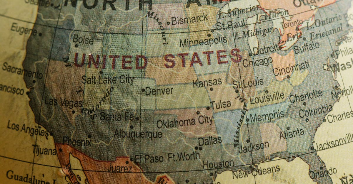
Point Roberts, Washington: A US Island in Canada
Moving closer to home, Point Roberts, Washington, presents a unique border scenario within North America. This small peninsula, jutting south from British Columbia, Canada, is part of the United States. To reach the rest of Washington State, residents of Point Roberts must cross two international borders – exiting the US into Canada, and then re-entering the US.
Point Roberts' unusual geography stems from the 1846 Oregon Treaty, which established the 49th parallel as the boundary between the US and British North America (later Canada). Due to a surveying error, Point Roberts ended up south of this line, but still belonging to the US.
This isolated community faces several challenges. Businesses often cater to Canadian customers due to their proximity. The school system is also affected; students attend school in the US, requiring a daily international commute. Furthermore, property values can be influenced by fluctuations in the Canadian dollar, given the significant Canadian presence.
Actionable Insight: Point Roberts exemplifies the challenges and opportunities that arise when communities are geographically isolated and heavily reliant on cross-border trade and interaction. Understanding the economic and social dynamics of such regions is crucial for developing effective policies that address their unique needs.
The Zambezi River: Where Four Countries Almost Meet
While not technically a quadripoint (a point where four countries meet), the area where Zambia, Zimbabwe, Botswana, and Namibia converge along the Zambezi River is remarkably close. Some maps even mistakenly depict it as a true quadripoint. The exact point of convergence is debated, with some arguing it's a highly contested and potentially fluctuating zone on the Zambezi River itself.
The historical significance of this near-quadripoint lies in the competition for access to the Zambezi River and the strategic chokepoint it represents. Had historical negotiations played out differently, this area could have become a focal point of international disputes.
Free Weekly Newsletter
Enjoying this guide?
Get the best articles like this one delivered to your inbox every week. No spam.
Actionable Insight: The near-quadripoint on the Zambezi highlights the importance of accurate mapping and clearly defined borders in preventing future conflicts. Even seemingly minor discrepancies in border demarcation can escalate into major international disputes, especially in areas with valuable resources or strategic importance.
Bir Tawil: The Land No One Wants
Finally, let's consider Bir Tawil, a truly bizarre case of a terra nullius – land claimed by no one. Located between Egypt and Sudan, this small, uninhabited territory is the result of conflicting border claims stemming from different historical definitions. Egypt asserts a border based on the 1899 political boundary, placing Bir Tawil within Sudan. Sudan, on the other hand, claims a border based on the 1902 administrative boundary, putting Bir Tawil within Egypt.
The reason neither country wants to claim Bir Tawil is because claiming it would mean relinquishing their claim to the Hala'ib Triangle, a much larger and more valuable territory located further east along the Red Sea coast. In essence, both countries prefer to maintain their claim to the resource-rich Hala'ib Triangle, even if it means foregoing any claim to the desolate and less-valuable Bir Tawil.
This has created a fascinating situation where Bir Tawil remains unclaimed, a testament to the complex interplay of territorial disputes, historical legacies, and strategic calculations.
Actionable Insight: Bir Tawil demonstrates how territorial disputes can be driven by strategic considerations and the relative value of different regions. It also illustrates the potential for unclaimed territories to emerge as a result of conflicting claims and a lack of incentive for any party to assert sovereignty.
Beyond the Borders: Understanding the World's Intricate Boundaries
These are just a few examples of the world's strangest borders. They are remnants of colonialism, products of historical treaties, and sometimes, simply the result of cartographical quirks. They serve as fascinating reminders that the lines we draw on maps are often arbitrary and subject to the vagaries of history and politics.
By understanding these unusual boundaries, we gain a deeper appreciation for the complex tapestry of international relations and the often-unexpected consequences of decisions made long ago. They also offer valuable insights into the challenges and opportunities that arise when cultures, economies, and political systems intersect across geographical boundaries. So, the next time you think about a border, remember that it's not just a line on a map; it's a dynamic and often surprising reflection of our shared history and interconnected future.
Frequently Asked Questions
The Strangest Borders Between Countries: Beyond the Lines on the Map
For most of us, the word "border" conjures up images of imposing checkpoints, guarded fences, and perhaps even contentious political debates. We envision the U.S.-Mexico border wall, or the heavily fortified line separating North and South Korea. But the world of international boundaries is far stranger, more nuanced, and occasionally downright absurd than these high-profile examples suggest. Forget neat lines drawn on maps; these are borders that snake through living rooms, bisect cafes, and even dictate which country you’re in while simply crossing a bridge. This article dives into some of the most unusual international borders in the world, exploring their history, quirky consequences, and what they reveal about the often-arbitrary nature of national identity.
The Enigmatic Enclaves: When Islands of Land Belong Elsewhere
Before we delve into specific border anomalies, let's understand the concept of an enclave. An enclave is a territory entirely surrounded by another country. Think of it as a geographical island belonging to a different nation. And then there are exclaves, a territory geographically separated from its main territory and surrounded by one or more other countries. Many of the strangest borders involve these odd geopolitical puzzles, born from historical quirks, treaties, and land swaps gone sideways.
Baarle-Hertog/Baarle-Nassau: A Dutch-Belgian Checkered Past… and Present
Perhaps the quintessential example of a border that's more of a maze than a line is the town of Baarle, split between Baarle-Hertog (Belgian) and Baarle-Nassau (Dutch). This isn't just one dividing line; it's a complex web of 22 Belgian exclaves within the Netherlands, interspersed with seven Dutch counter-enclaves inside those Belgian ones. To further complicate matters, some buildings are even bisected by the border!
The origins of this bizarre arrangement date back to medieval land deals and ownership rights that were never neatly resolved. Over centuries, as larger kingdoms and nations formed, these fragmented landholdings remained, resulting in the Baarle we see today.
So, how do people live in a town where you might literally step into a different country within your own house? The solution is… relative simplicity. The border is marked by crosses on the pavement, and each house is considered to be in the country where its front door is located. If the front door falls squarely on the border, nationality is determined by the address of the primary living space. This can lead to situations where residents literally rearrange their furniture to officially reside in the more advantageous nation for tax purposes or social benefits.
During the COVID-19 pandemic, the Baarle border caused significant disruption. Border crossings were restricted, meaning residents couldn't freely visit shops or family members located just meters away on the other side. This highlighted the everyday impact of these unusual boundaries, even on mundane tasks like grocery shopping.
Actionable Insight: While the Baarle situation may seem like a geographical anomaly, it highlights the importance of clear and enforceable property rights in a globalized world. Complex ownership structures and unclear jurisdictional boundaries can lead to conflicts and inefficiencies, especially during times of crisis.
The Curious Case of Llívia: Spain Surrounded by France
Tucked deep within the French Pyrenees, just a few kilometers from the Spanish border, lies Llívia, a Spanish enclave. This town, population just over 1,500, boasts a rich history dating back to Roman times. Its peculiar status stems from the 1659 Treaty of the Pyrenees, which ceded several villages in the region to France. However, Llívia, due to its status as a "town" (and not a village) was specifically excluded from the treaty.
The border around Llívia isn’t particularly remarkable physically; it’s mostly marked by road signs indicating the transition from France to Spain. However, the logistical implications are fascinating. To reach the rest of Spain, residents of Llívia must travel through French territory. The Spanish government maintains a road, considered neutral territory, connecting Llívia to Spain, though it still traverses through France.
Actionable Insight: Llívia's situation illustrates how historical agreements, even those centuries old, can have lasting impacts on contemporary geopolitics. It also demonstrates the creative solutions countries can devise to maintain territorial integrity and provide access to geographically isolated regions.
Point Roberts, Washington: A US Island in Canada
Moving closer to home, Point Roberts, Washington, presents a unique border scenario within North America. This small peninsula, jutting south from British Columbia, Canada, is part of the United States. To reach the rest of Washington State, residents of Point Roberts must cross two international borders – exiting the US into Canada, and then re-entering the US.
Point Roberts' unusual geography stems from the 1846 Oregon Treaty, which established the 49th parallel as the boundary between the US and British North America (later Canada). Due to a surveying error, Point Roberts ended up south of this line, but still belonging to the US.
This isolated community faces several challenges. Businesses often cater to Canadian customers due to their proximity. The school system is also affected; students attend school in the US, requiring a daily international commute. Furthermore, property values can be influenced by fluctuations in the Canadian dollar, given the significant Canadian presence.
Actionable Insight: Point Roberts exemplifies the challenges and opportunities that arise when communities are geographically isolated and heavily reliant on cross-border trade and interaction. Understanding the economic and social dynamics of such regions is crucial for developing effective policies that address their unique needs.
The Zambezi River: Where Four Countries Almost Meet
While not technically a quadripoint (a point where four countries meet), the area where Zambia, Zimbabwe, Botswana, and Namibia converge along the Zambezi River is remarkably close. Some maps even mistakenly depict it as a true quadripoint. The exact point of convergence is debated, with some arguing it's a highly contested and potentially fluctuating zone on the Zambezi River itself.
The historical significance of this near-quadripoint lies in the competition for access to the Zambezi River and the strategic chokepoint it represents. Had historical negotiations played out differently, this area could have become a focal point of international disputes.
Actionable Insight: The near-quadripoint on the Zambezi highlights the importance of accurate mapping and clearly defined borders in preventing future conflicts. Even seemingly minor discrepancies in border demarcation can escalate into major international disputes, especially in areas with valuable resources or strategic importance.
Bir Tawil: The Land No One Wants
Finally, let's consider Bir Tawil, a truly bizarre case of a terra nullius – land claimed by no one. Located between Egypt and Sudan, this small, uninhabited territory is the result of conflicting border claims stemming from different historical definitions. Egypt asserts a border based on the 1899 political boundary, placing Bir Tawil within Sudan. Sudan, on the other hand, claims a border based on the 1902 administrative boundary, putting Bir Tawil within Egypt.
The reason neither country wants to claim Bir Tawil is because claiming it would mean relinquishing their claim to the Hala'ib Triangle, a much larger and more valuable territory located further east along the Red Sea coast. In essence, both countries prefer to maintain their claim to the resource-rich Hala'ib Triangle, even if it means foregoing any claim to the desolate and less-valuable Bir Tawil.
This has created a fascinating situation where Bir Tawil remains unclaimed, a testament to the complex interplay of territorial disputes, historical legacies, and strategic calculations.
Actionable Insight: Bir Tawil demonstrates how territorial disputes can be driven by strategic considerations and the relative value of different regions. It also illustrates the potential for unclaimed territories to emerge as a result of conflicting claims and a lack of incentive for any party to assert sovereignty.
Beyond the Borders: Understanding the World's Intricate Boundaries
These are just a few examples of the world's strangest borders. They are remnants of colonialism, products of historical treaties, and sometimes, simply the result of cartographical quirks. They serve as fascinating reminders that the lines we draw on maps are often arbitrary and subject to the vagaries of history and politics.
By understanding these unusual boundaries, we gain a deeper appreciation for the complex tapestry of international relations and the often-unexpected consequences of decisions made long ago. They also offer valuable insights into the challenges and opportunities that arise when cultures, economies, and political systems intersect across geographical boundaries. So, the next time you think about a border, remember that it's not just a line on a map; it's a dynamic and often surprising reflection of our shared history and interconnected future.
About Zeebrain Editorial
Zeebrain publishes independent analysis of markets, investing, personal finance, and business. We disclose affiliate relationships, never accept payment for coverage, and fact-check all claims against primary sources. Read our editorial policy →
More from Travel & Places


Related Guides
Keep exploring this topic
Explore More Categories
Keep browsing by topic and build depth around the subjects you care about most.