What China's Stone Forest Reveals About Cities and Climate
Quick Summary
China's Stone Forest isn't just a geological wonder — it's a living laboratory reshaping how scientists think about urban climate, city design, and conservation.
In This Article
A Forest That Took 260 Million Years to Grow
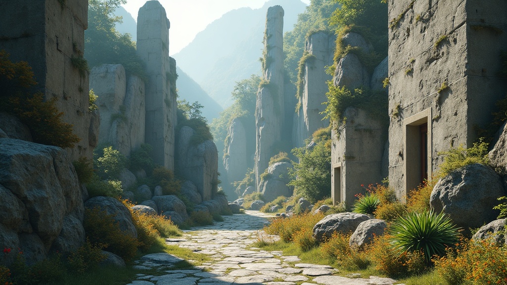
Most forests take decades to mature. China's Stone Forest took a quarter of a billion years. Located in Yunnan Province, roughly 80 kilometres southeast of the provincial capital Kunming, the Shilin World Geopark is a labyrinth of limestone pillars, arched caverns, mushroom-shaped towers, and narrow tunnels spread across more than 350 square kilometres. Some of those pillars reach 30 metres into the sky. UNESCO designated the site a World Heritage landmark in 2007, and it's not hard to see why.

But the Stone Forest is more than a dramatic landscape worth photographing. It's a geological archive, a fossil record, a climate analogue for modern cities, and — perhaps most urgently — a fragile ecosystem under threat. The more scientists study it, the more it turns out this ancient terrain has surprisingly practical things to say about the world we're building right now.
How Karstification Sculpts Stone Into Skylines
The rock beneath the Stone Forest is more than 260 million years old, predating the dinosaurs by tens of millions of years. Back then, what is now Yunnan Province lay beneath the Paleo-Tethys Sea, a vast ancient ocean whose shallow waters teemed with shell-building organisms — molluscs, gastropods, plankton, algae. When these creatures died, their calcium carbonate shells accumulated on the seafloor, compressed over millennia into limestone and dolostone.
Tectonic activity eventually pushed those seafloor layers upward, exposing them to the surface. That's when the real sculptor got to work: water.
Carbonate rocks like limestone are chemically vulnerable to slightly acidic rainwater. As water seeps into natural cracks and fissures, it dissolves the rock from the inside out. Over geological timescales, small crevices widen into gullies, gullies deepen into chasms, and solid hills are gradually carved into isolated pillars. This process — karstification — is responsible for some of the world's most dramatic landscapes, from the cave systems of Slovenia to the tower karst of Vietnam's Ha Long Bay.
What makes Shilin exceptional is its sheer variety. Scientists have identified nearly every known type of karst formation within this single site. It functions, in geological terms, as a complete catalogue — which is precisely why researchers return to it again and again.
The finer details reveal just how nuanced the process is. Pillars with wider tops and narrow bases formed because the lower layers of rock contained more fractures, causing the base to erode faster than the cap. Tiny grooves and channels etched into individual rocks record the precise paths rainwater took over thousands of years. Each formation is, in effect, a three-dimensional weather diary.
What Buried Stone Forests Tell Us About Volcanic Catastrophe
Not every stone forest makes it to the surface. Near Shilin, geologists have discovered ancient karst landscapes buried beneath layers of ash and lava deposited more than 250 million years ago — roughly coinciding with the end-Permian mass extinction, the most catastrophic extinction event in Earth's history.
These subterranean formations — complete with caverns, sinkholes, and stone pillars — were entombed by volcanic eruptions before they ever saw daylight. Their discovery adds a sobering dimension to the Stone Forest story: what we see above ground today is only what survived. Entire geological epochs of karstification can be erased by a single volcanic event.
For geologists, these buried forests are invaluable. They provide a snapshot of how carbonate landscapes behaved under very different atmospheric and climatic conditions, offering comparison points for modelling how present-day karst systems might respond to rapid environmental change.
The Stone Forest's Hidden Climate Secret
Here's where the story takes an unexpected turn toward the urban. Researchers studying the microclimate of the Stone Forest have found that its dense clusters of tall rock pillars create a distinctive thermal environment. Compared to the surrounding open landscape, the Stone Forest tends to run warmer on average — all that exposed rock absorbs solar radiation efficiently, much like a concrete wall in summer. But the temperature fluctuations across the day are notably less extreme, and daily peak temperatures tend to arrive later than in open areas, as the pillars create cooling shade during critical midday hours.
If that pattern sounds familiar, it should. It's almost exactly what urban climatologists observe in cities full of skyscrapers.
The phenomenon known as the urban heat island effect describes how densely built cities trap heat, alter wind patterns, and create temperature profiles markedly different from the rural areas surrounding them. Studying this in actual cities, however, is complicated. Cars, air conditioning units, industrial heat exhaust, air pollution — all of these variables contaminate the data and make it hard to isolate the specific contribution of building geometry to urban temperature.
The Stone Forest sidesteps all of that. It has skyscraper-scale vertical structures without a single combustion engine or rooftop HVAC unit. It is, effectively, a city-shaped landscape running on nothing but geology and weather. That makes it an extraordinarily clean natural experiment — one that researchers are now using to disentangle the thermal effects of urban form from those of urban activity.
The implications are significant. If we can better understand how tall, densely packed structures shape local temperatures in a purely natural setting, we can use those insights to inform how cities are designed — where to place parks and green corridors, how to orient streets and buildings to maximise natural airflow, and how urban geometry itself might be rethought to reduce heat stress on residents.
The Living Ecosystem Inside a Stone Landscape
For all its geological drama, the Stone Forest is not merely rock. The formations support a complex ecosystem of plants, insects, reptiles, and birds adapted to the microhabitats created by the pillars. Crevices between rocks shelter moisture-loving ferns and mosses. Rare orchid species cling to shaded faces. Migratory birds use the pillars as navigation landmarks.
This ecosystem is in trouble. Increased tourist footfall, encroaching agriculture, and broader land-use changes in the surrounding region have disrupted the natural balance. Research has documented an expansion of barren, degraded areas within the geopark and a measurable contraction of the living forest that grows within and around the stone formations. Karst ecosystems are uniquely sensitive: the thin soils that develop in these environments take centuries to form and can be destroyed in a single season of overuse.
Conservation teams are now working on integrated management plans that attempt to balance public access with ecological restoration. This includes revegetation programmes, stricter zoning around the most sensitive formations, and community engagement with local Yi and Sani ethnic groups whose cultural relationship with the Stone Forest stretches back centuries. For these communities, Shilin is not just a tourist destination — it is a place of ancestral significance, embedded in oral histories, festivals, and traditional knowledge about the land.
What the Stone Forest Teaches Urban Planners Right Now
The practical lessons emerging from Stone Forest research are beginning to filter into conversations about sustainable urban design. Several key principles are gaining traction:
Geometry matters as much as materials. The thermal behaviour of the Stone Forest suggests that the shape and spacing of vertical structures significantly influence local temperature dynamics — independent of what those structures are made of or what goes on inside them. Urban planners who focus exclusively on building materials and energy systems may be missing a major lever.
Natural analogues can replace expensive simulations. Climate modelling for cities is computationally intensive and depends on accurate input data that is often unavailable in developing regions. Natural karst landscapes offer a low-cost, high-resolution alternative for studying how vertical topography interacts with solar radiation and airflow.
Conservation and innovation are not opposites. The push to preserve the Stone Forest and the push to learn from it are entirely compatible. In fact, they reinforce each other: a degraded landscape yields worse data, and rigorous scientific study generates the evidence base needed to justify conservation funding.
Free Weekly Newsletter
Enjoying this guide?
Get the best articles like this one delivered to your inbox every week. No spam.
None of this means we should start building cities that look like karst formations. But it does mean that one of the world's most ancient landscapes is actively contributing to one of the most pressing conversations of our time: how do we build human environments that work with climate rather than against it?
Preserving the Archive Before It Changes Beyond Recognition
The Stone Forest is still changing. Erosion continues. The pillars are, in some measurable sense, still growing — as the soil at ground level erodes faster than the rock above it, the pillars effectively gain height relative to the surface. The landscape that greeted the first human eyes to see it is not the landscape that exists today, and the landscape today will not be the one future generations inherit.
That's not necessarily alarming — geological change is the norm, not the exception. What is alarming is the pace of ecological change driven by human activity, which threatens to degrade the living systems that give the Stone Forest much of its scientific and cultural value long before natural erosion would.
The case for protecting Shilin isn't just aesthetic, though it certainly is that. It's epistemic. This is a place where the deep past and the uncertain future are in direct conversation, written in stone and water, and we are only just learning to read it.
Frequently Asked Questions
What is China's Stone Forest and where is it located?
China's Stone Forest, officially known as Shilin World Geopark, is a UNESCO World Heritage Site in Yunnan Province, southern China, approximately 80 kilometres southeast of Kunming. It covers more than 350 square kilometres and features thousands of limestone pillars, some reaching 30 metres in height, formed over hundreds of millions of years through a geological process called karstification.
How did the Stone Forest form?
The rock in the Stone Forest is over 260 million years old, originally deposited as seafloor sediment in the ancient Paleo-Tethys Sea. Tectonic activity pushed these carbonate rock layers to the surface, where slightly acidic rainwater slowly dissolved and sculpted the stone along natural cracks and fissures over geological timescales. This process — karstification — is still ongoing today.
Why are scientists studying the Stone Forest to understand cities?
The Stone Forest produces a microclimate strikingly similar to urban heat island conditions observed in cities full of skyscrapers — higher average temperatures, dampened daily fluctuations, and delayed peak heat. Because the Stone Forest has city-like geometry without the complicating variables of traffic, industry, and air conditioning, it offers researchers a clean natural experiment for isolating how vertical structure alone shapes local temperature. These findings could inform more climate-resilient urban design.
Is the Stone Forest under threat?
Yes. Human activity in and around the geopark has led to measurable ecological degradation, including the expansion of barren areas and shrinkage of the living forest ecosystem within the park. Karst ecosystems are particularly vulnerable because their thin soils form very slowly and are easily destroyed. Scientists and conservationists are working on integrated management strategies to balance public access with ecological restoration and protect both the geological and biological heritage of the site.
Are there other stone forests like Shilin elsewhere in the world?
Yes. Similar karst landscapes exist in other Chinese provinces as well as in Malaysia, Indonesia, Australia, and Brazil, among other countries. All formed through the same fundamental process of carbonate rock dissolution by water. However, Shilin is considered uniquely significant because it contains examples of nearly every known type of karst formation within a single contiguous area.
Frequently Asked Questions
A Forest That Took 260 Million Years to Grow
Most forests take decades to mature. China's Stone Forest took a quarter of a billion years. Located in Yunnan Province, roughly 80 kilometres southeast of the provincial capital Kunming, the Shilin World Geopark is a labyrinth of limestone pillars, arched caverns, mushroom-shaped towers, and narrow tunnels spread across more than 350 square kilometres. Some of those pillars reach 30 metres into the sky. UNESCO designated the site a World Heritage landmark in 2007, and it's not hard to see why.
But the Stone Forest is more than a dramatic landscape worth photographing. It's a geological archive, a fossil record, a climate analogue for modern cities, and — perhaps most urgently — a fragile ecosystem under threat. The more scientists study it, the more it turns out this ancient terrain has surprisingly practical things to say about the world we're building right now.
How Karstification Sculpts Stone Into Skylines
The rock beneath the Stone Forest is more than 260 million years old, predating the dinosaurs by tens of millions of years. Back then, what is now Yunnan Province lay beneath the Paleo-Tethys Sea, a vast ancient ocean whose shallow waters teemed with shell-building organisms — molluscs, gastropods, plankton, algae. When these creatures died, their calcium carbonate shells accumulated on the seafloor, compressed over millennia into limestone and dolostone.
Tectonic activity eventually pushed those seafloor layers upward, exposing them to the surface. That's when the real sculptor got to work: water.
Carbonate rocks like limestone are chemically vulnerable to slightly acidic rainwater. As water seeps into natural cracks and fissures, it dissolves the rock from the inside out. Over geological timescales, small crevices widen into gullies, gullies deepen into chasms, and solid hills are gradually carved into isolated pillars. This process — karstification — is responsible for some of the world's most dramatic landscapes, from the cave systems of Slovenia to the tower karst of Vietnam's Ha Long Bay.
What makes Shilin exceptional is its sheer variety. Scientists have identified nearly every known type of karst formation within this single site. It functions, in geological terms, as a complete catalogue — which is precisely why researchers return to it again and again.
The finer details reveal just how nuanced the process is. Pillars with wider tops and narrow bases formed because the lower layers of rock contained more fractures, causing the base to erode faster than the cap. Tiny grooves and channels etched into individual rocks record the precise paths rainwater took over thousands of years. Each formation is, in effect, a three-dimensional weather diary.
What Buried Stone Forests Tell Us About Volcanic Catastrophe
Not every stone forest makes it to the surface. Near Shilin, geologists have discovered ancient karst landscapes buried beneath layers of ash and lava deposited more than 250 million years ago — roughly coinciding with the end-Permian mass extinction, the most catastrophic extinction event in Earth's history.
These subterranean formations — complete with caverns, sinkholes, and stone pillars — were entombed by volcanic eruptions before they ever saw daylight. Their discovery adds a sobering dimension to the Stone Forest story: what we see above ground today is only what survived. Entire geological epochs of karstification can be erased by a single volcanic event.
For geologists, these buried forests are invaluable. They provide a snapshot of how carbonate landscapes behaved under very different atmospheric and climatic conditions, offering comparison points for modelling how present-day karst systems might respond to rapid environmental change.
The Stone Forest's Hidden Climate Secret
Here's where the story takes an unexpected turn toward the urban. Researchers studying the microclimate of the Stone Forest have found that its dense clusters of tall rock pillars create a distinctive thermal environment. Compared to the surrounding open landscape, the Stone Forest tends to run warmer on average — all that exposed rock absorbs solar radiation efficiently, much like a concrete wall in summer. But the temperature fluctuations across the day are notably less extreme, and daily peak temperatures tend to arrive later than in open areas, as the pillars create cooling shade during critical midday hours.
If that pattern sounds familiar, it should. It's almost exactly what urban climatologists observe in cities full of skyscrapers.
The phenomenon known as the urban heat island effect describes how densely built cities trap heat, alter wind patterns, and create temperature profiles markedly different from the rural areas surrounding them. Studying this in actual cities, however, is complicated. Cars, air conditioning units, industrial heat exhaust, air pollution — all of these variables contaminate the data and make it hard to isolate the specific contribution of building geometry to urban temperature.
The Stone Forest sidesteps all of that. It has skyscraper-scale vertical structures without a single combustion engine or rooftop HVAC unit. It is, effectively, a city-shaped landscape running on nothing but geology and weather. That makes it an extraordinarily clean natural experiment — one that researchers are now using to disentangle the thermal effects of urban form from those of urban activity.
The implications are significant. If we can better understand how tall, densely packed structures shape local temperatures in a purely natural setting, we can use those insights to inform how cities are designed — where to place parks and green corridors, how to orient streets and buildings to maximise natural airflow, and how urban geometry itself might be rethought to reduce heat stress on residents.
The Living Ecosystem Inside a Stone Landscape
For all its geological drama, the Stone Forest is not merely rock. The formations support a complex ecosystem of plants, insects, reptiles, and birds adapted to the microhabitats created by the pillars. Crevices between rocks shelter moisture-loving ferns and mosses. Rare orchid species cling to shaded faces. Migratory birds use the pillars as navigation landmarks.
This ecosystem is in trouble. Increased tourist footfall, encroaching agriculture, and broader land-use changes in the surrounding region have disrupted the natural balance. Research has documented an expansion of barren, degraded areas within the geopark and a measurable contraction of the living forest that grows within and around the stone formations. Karst ecosystems are uniquely sensitive: the thin soils that develop in these environments take centuries to form and can be destroyed in a single season of overuse.
Conservation teams are now working on integrated management plans that attempt to balance public access with ecological restoration. This includes revegetation programmes, stricter zoning around the most sensitive formations, and community engagement with local Yi and Sani ethnic groups whose cultural relationship with the Stone Forest stretches back centuries. For these communities, Shilin is not just a tourist destination — it is a place of ancestral significance, embedded in oral histories, festivals, and traditional knowledge about the land.
What the Stone Forest Teaches Urban Planners Right Now
The practical lessons emerging from Stone Forest research are beginning to filter into conversations about sustainable urban design. Several key principles are gaining traction:
Geometry matters as much as materials. The thermal behaviour of the Stone Forest suggests that the shape and spacing of vertical structures significantly influence local temperature dynamics — independent of what those structures are made of or what goes on inside them. Urban planners who focus exclusively on building materials and energy systems may be missing a major lever.
Natural analogues can replace expensive simulations. Climate modelling for cities is computationally intensive and depends on accurate input data that is often unavailable in developing regions. Natural karst landscapes offer a low-cost, high-resolution alternative for studying how vertical topography interacts with solar radiation and airflow.
Conservation and innovation are not opposites. The push to preserve the Stone Forest and the push to learn from it are entirely compatible. In fact, they reinforce each other: a degraded landscape yields worse data, and rigorous scientific study generates the evidence base needed to justify conservation funding.
None of this means we should start building cities that look like karst formations. But it does mean that one of the world's most ancient landscapes is actively contributing to one of the most pressing conversations of our time: how do we build human environments that work with climate rather than against it?
Preserving the Archive Before It Changes Beyond Recognition
The Stone Forest is still changing. Erosion continues. The pillars are, in some measurable sense, still growing — as the soil at ground level erodes faster than the rock above it, the pillars effectively gain height relative to the surface. The landscape that greeted the first human eyes to see it is not the landscape that exists today, and the landscape today will not be the one future generations inherit.
That's not necessarily alarming — geological change is the norm, not the exception. What is alarming is the pace of ecological change driven by human activity, which threatens to degrade the living systems that give the Stone Forest much of its scientific and cultural value long before natural erosion would.
The case for protecting Shilin isn't just aesthetic, though it certainly is that. It's epistemic. This is a place where the deep past and the uncertain future are in direct conversation, written in stone and water, and we are only just learning to read it.
Frequently Asked Questions
What is China's Stone Forest and where is it located?
China's Stone Forest, officially known as Shilin World Geopark, is a UNESCO World Heritage Site in Yunnan Province, southern China, approximately 80 kilometres southeast of Kunming. It covers more than 350 square kilometres and features thousands of limestone pillars, some reaching 30 metres in height, formed over hundreds of millions of years through a geological process called karstification.
How did the Stone Forest form?
The rock in the Stone Forest is over 260 million years old, originally deposited as seafloor sediment in the ancient Paleo-Tethys Sea. Tectonic activity pushed these carbonate rock layers to the surface, where slightly acidic rainwater slowly dissolved and sculpted the stone along natural cracks and fissures over geological timescales. This process — karstification — is still ongoing today.
Why are scientists studying the Stone Forest to understand cities?
The Stone Forest produces a microclimate strikingly similar to urban heat island conditions observed in cities full of skyscrapers — higher average temperatures, dampened daily fluctuations, and delayed peak heat. Because the Stone Forest has city-like geometry without the complicating variables of traffic, industry, and air conditioning, it offers researchers a clean natural experiment for isolating how vertical structure alone shapes local temperature. These findings could inform more climate-resilient urban design.
Is the Stone Forest under threat?
Yes. Human activity in and around the geopark has led to measurable ecological degradation, including the expansion of barren areas and shrinkage of the living forest ecosystem within the park. Karst ecosystems are particularly vulnerable because their thin soils form very slowly and are easily destroyed. Scientists and conservationists are working on integrated management strategies to balance public access with ecological restoration and protect both the geological and biological heritage of the site.
Are there other stone forests like Shilin elsewhere in the world?
Yes. Similar karst landscapes exist in other Chinese provinces as well as in Malaysia, Indonesia, Australia, and Brazil, among other countries. All formed through the same fundamental process of carbonate rock dissolution by water. However, Shilin is considered uniquely significant because it contains examples of nearly every known type of karst formation within a single contiguous area.
About Zeebrain Editorial
Zeebrain publishes independent analysis of markets, investing, personal finance, and business. We disclose affiliate relationships, never accept payment for coverage, and fact-check all claims against primary sources. Read our editorial policy →
How this article was produced: Zeebrain articles are created with AI assistance from primary sources (including cited videos and market data) and reviewed under our editorial standards before publication. Spot an error? Tell us and we will correct it.
More from Curiosities




Related Guides
Keep exploring this topic
Explore More Categories
Keep browsing by topic and build depth around the subjects you care about most.